|
Exhibition Links
|

A Journey from Prince of Wales's Fort in Hudson's Bay, to the Northern Ocean. Undertaken by Order of the Hudson's Bay Company, for the Discovery of Copper Mines, a Northwest Passage, &c., in the Years 1769, 1770, 1771, & 1772. London, 1795. [Rare Books Division: Gift of John G. Buchanan, Princeton Class of 1909, in memory of Major General Julius Ochs]
A London-born employee of the Hudson's Bay Company, Hearne has the distinction of being the first European to view the "Northern Ocean," and his expedition proved that no passage existed through the continent south of that body of water. After two false starts (in 1769 and early 1770) due to poor guides and unexpected misfortunes, Hearne obtained the services of a respected Indian leader, called Matonabbee, who had been adopted as a boy by Richard Norton, Governor of the Prince of Wales Fort, when his father died. With Matonabbee guiding and the addition of Indian women to do much of the physical labor so that the men could hunt—the lack of women laborers was Matonabbee's major explanation for the earlier troubles—Hearne's third attempt, begun on 7 December 1770, succeeded in reaching and descending the Coppermine River by the middle of July 1771, just hours after Indians in his party had massacred a camp of Eskimo [Inuit] fishermen, women, and children.
It was then about five o'clock in the morning of the seventeenth, the sea being in sight from the North West by West to the North East, about eight miles distant. I therefore set instantly about commencing my survey, and pursued it to the mouth of the river, which I found all the way so full of shoals and falls that it was not navigable even for a boat, and that it emptied itself into the sea over a ridge or bar. The tide was then out; but I judged from the marks which I saw on the edge of the ice, that it flowed about twelve or fourteen feet, which will only reach a little way within the river's mouth. The tide being out, the water in the river was perfectly fresh; but I am certain of its being the sea, or some branch of it, by the quantity of whalebone and seal-skins which the Esquimaux [just recently killed] had at their tents, and also by the number of seals which I saw on the ice. At the mouth of the river, the sea is full of islands and shoals, as far as I could see with the assistance of a good pocket telescope. The ice was not then broke up, but was melted away for about three quarters of a mile from the main shore, and to a little distance round the islands and shoals. By the time I had completed this survey, it was about one in the morning of the eighteenth . . . a thick fog and drizzling rain then came up, and finding that neither the river nor sea were likely to be of any use, I did not think it worth while to wait for fair weather to determine the latitude exactly by an observation . . . [Hearne, pp. 162-163.]
Sir John Franklin, arriving on his second expedition fifty years later, would prove that Hearne's latitude, given on his published map, was over one hundred miles off (too far north).

[Northern Indian canoe]
Immediately after our arrival at Clowey [May, 1771], the Indians began to build their canoes . . . Those vessels, though made of the same materials with the canoes of the Southern Indians, differ from them both in shape and construction; they are also much smaller and lighter; and although very slight and simple in their construction, are nevertheless the best that could possibly be contrived for the use of those poor people, who are frequently obliged to carry them a hundred, and sometimes a hundred and fifty miles at a time, without having occasion to put them into the water. . . . In shape the Northern Indian canoe bears some resemblance to a weaver's shuttle; being flat-bottomed, with straight upright sides, and sharp at each end, but the stern is by far the widest part, as there the baggage is generally laid, and occasionally a second person, who always lies down at full length in the bottom of the canoe. In this manner they carry one another across rivers and narrow parts of lakes in those little vessels, which seldom exceed twelve or thirteen feet in length, and are from twenty inches to two feet broad in the widest part. [Hearne, pp. 96-98.]
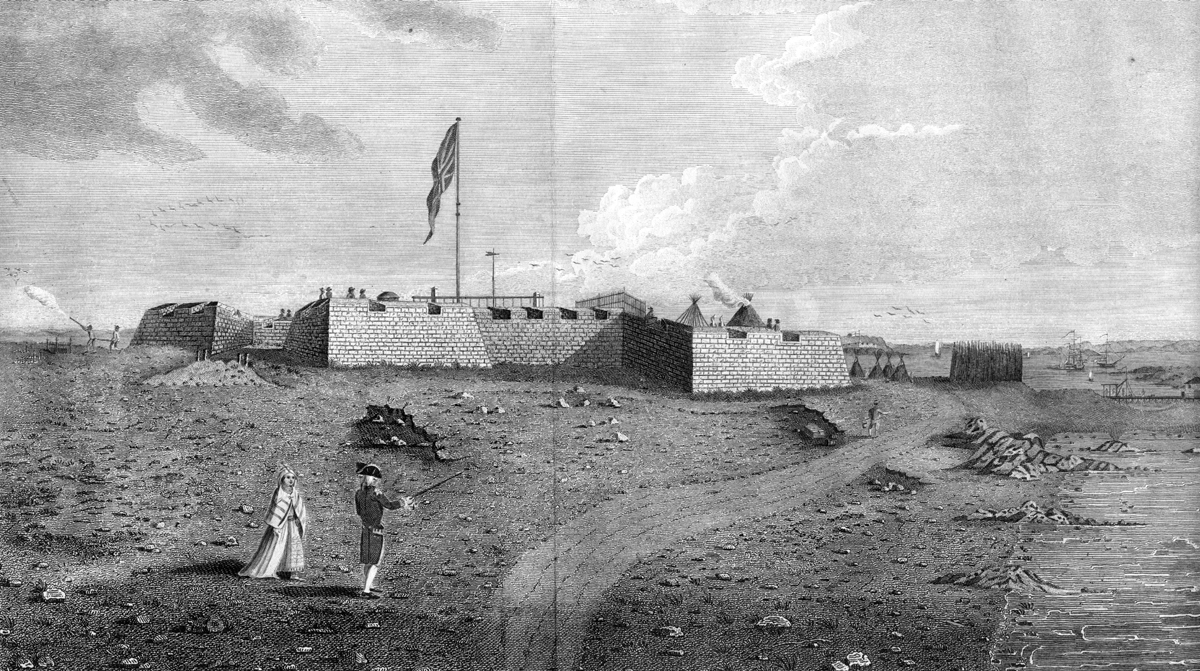
"A North West View of Prince of Wale's Fort in Hudson's Bay, North America" ( 1777) is taken from Hearne's book. Begun in 1732, the fort was completed forty years later. This Hudson's Bay Company station was the site of the start and end of Hearne's three expeditions. He became governor of the area in 1775 and was captured by the French naval commander La Perouse in 1782, when the fort was plundered.
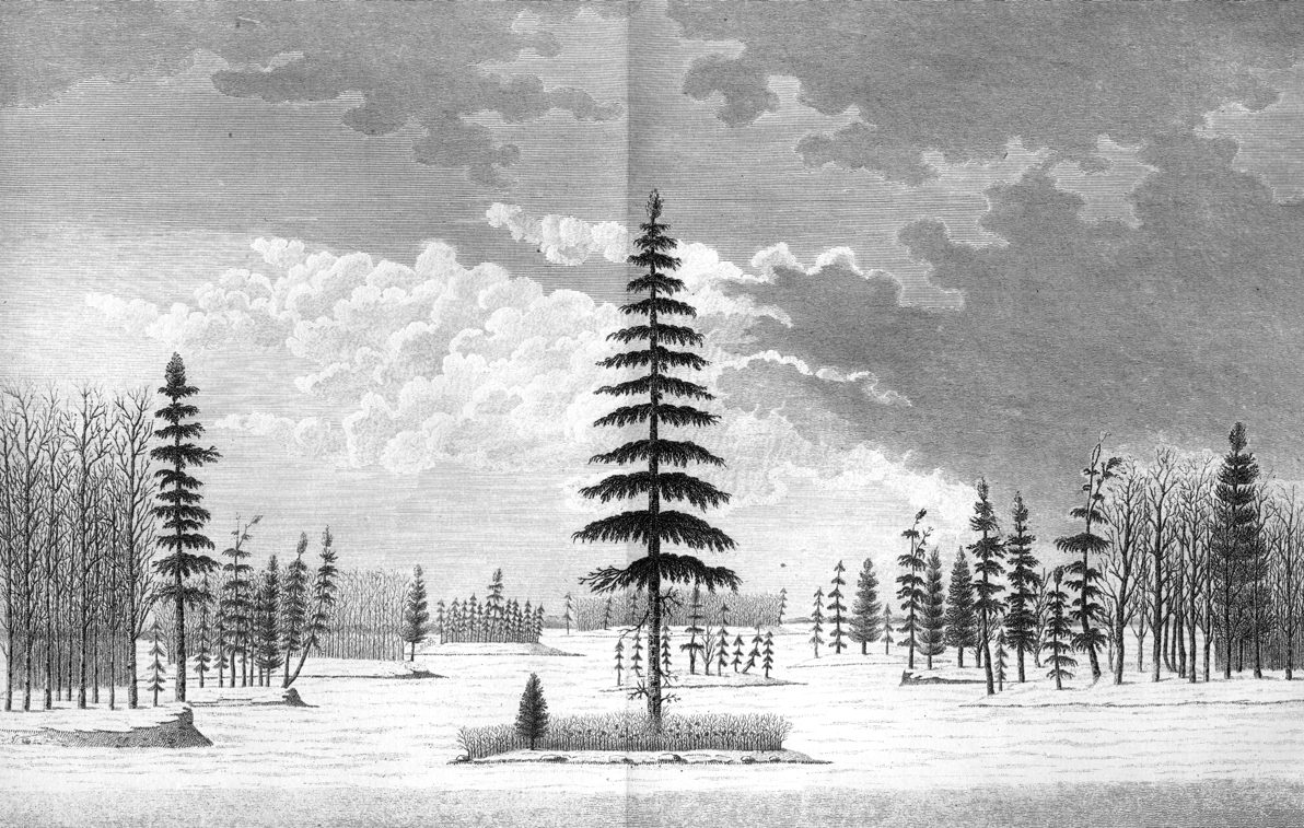
"A Winter View in the Athapuscow Lake" (January 1772), also from Hearne's book. Now called Great Slave Lake, this lake also figured in Mackenzie's 1789 trek.