“Burnet Inlet. Barrow's Strait” [drawn and engraved by W. Westall from a sketch by Henry Parkyns Hoppner]
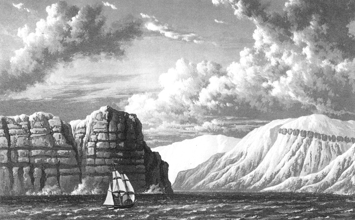
At noon, being in latitude 74° 15' 53" N., longitude, by chronometers, 86° 30' 30", we were near two inlets, of which the easternmost was named BURNET INLET, and the other STRATTON INLET. The land between these two had very much the appearance of an island. We rounded to, for the purpose of sounding, as well as to wait for our consort, and found no bottom with one-hundred and seventy fathoms of line, the water being of a dirty light-green colour. The cliffs on this part of the coast present a singular appearance, being stratified horizontally, and having a number of regular projecting masses of rock, broad at the bottom, and coming to a point at the top, resembling so many buttresses, raised by an art at equal intervals. This very remarkable constructure, which continues with little variation along the whole of this northern shore, will be best understood by the accompanying views of Lieutenant Beechey, which, from the accuracy with which the coast is delineated, will, I doubt not, be considered equally valuable by the geologist and the seaman. [Parry, p. 34. He refers to similar views to the one shown.]